The buildings at the center of Madrid do not breathe. At least in the way I am used to in Minnesota. They share space and they touch one another. One building ends and another begins, designed and destined in (sometimes) different centuries for different purposes.
Today we toured along the Paseo de la Castellana, a road which leads out of the city to Chamartín, Madrid Norte, the north. We moved out from the center of Madrid to a different kind of center: a financial area built in the late 20th century and further up the road to another center of concentrated finance and wealth built in the 21st century.
Before reaching the two financial centers: hubs of skyscrapers with plazas between them, we observed a set of two towers, the Colón Towers. The towers were built in 1976. Their proximity and interaction with the street, the sidewalk, and the adjacent building, which was clearly much older, felt exceptional compared to what we saw next.
Commonly, the financial area of a city lies at the city center, but in Madrid the buildings are already so dense en centro. On our tour it was suggested that the largest buildings and what takes place in them can say a lot about a city; we heard an appeal for us to see that certain things (i.e. financial areas) belong at the center of the city while other things do not. For example, a sheet metal shop or vacant land close to the city center should read as out of place because these uses/non-uses are “back of the house” kind of activities.
However, it was clear that two plazas of towers we visited lacked something that existed at the center of Madrid and even at the Colón Towers: a clear interest in interacting with their surroundings or the street or public life. The exception may be the highly surveilled tower for Cespa (oil and gas company) which was designed to face the city center and to feel close from afar. The two complexes of skyscrapers, seven in all, were set back from Paseo de Castellana and had turned their backs to the street and were built into plazas of their own, neither of which invited people in. Their ground floors did not hold shops like in other parts of the city. They all have space, plazas, between them so that I could almost walk around the entirety of each building if I chose (but I will most certainly be surveilled). These complexes were simultaneously available and unwelcoming. The plazas do not feel like they were made for people, but to give space between towers (each of which comes attached with more than one big name: the owner, the designer, the builder…).
So even though the two complexes of towers, Torres, may be “out of place” (not in the center), they have been designed and placed differently from buildings at the city center. While they may not be “back of the shop” activities, they also are not accessible for public use. These buildings may have breathing room, but do not support the surrounding life.
-Kendra Klenz
Madrid’s organizational footprint has been shaped and defined by a long process of expansion outwards from the city center, punctuated by several periods of rapid development in the 20th century. Narrow, winding, and crowded streets create an intricate labyrinth near the old city center around “Sol” and “Plaza Mayor.” This pattern is eventually interrupted by two main axes leading to the [distinctly modern] outskirts of the city.
Daniel Glattstein Siminovich, an architect and professor based in Madrid, guided our group along the main north-south axis of the city from the historic Atocha station in the south to the site of a proposed urban renewal project in the city’s Chamartín neighborhood to the north. Our transect, which followed the arterial Paseo de la Castallana, was chosen to reveal and contextualize the most important periods of urban development within the city and to establish a base from which to analyze the controversial “Madrid Nuevo Norte” project in Chamartín.
We began our tour on the south side of the city near Puerta de Atocha, Madrid’s main rail hub and terminus for several high-speed lines extending south and eastbound towards Barcelona, Sevilla, Cordoba, Malaga, and Valencia. From the main circle, the station presents itself as a magnificent arching gateway decorated by an ornate wrought-iron window designed collaboratively by Alberto de Palacio Elissagne and Gustave Eiffel (designer of La Tour Eiffel). To the north of the station is the city’s famous Parque de El Retiro. To the west is the Reina Sofia Art Museum, which houses Picasso’s Guernica, among countless other important works.
Rail lines run south from Atocha station into a neighborhood where massive new office and housing developments tower over grassy vacant lots, public playgrounds, and small shops. Looking east from Calle Méndez Álvaro we could see a large open area carved out by the rail lines and bridges leading to the central station. To the west our attention was drawn to a heterogenous mix of brick and stucco retail, six-to-eight-story 20th century apartment buildings, and a spattering of new, state-of-the-art buildings such as the LEED Platinum Repsol headquarters (one of the largest oil and gas companies in Europe).
Driving northbound on Paseo del Prado we moved into the heart of the city where beautiful and monumental neoclassical buildings from the 17th, 18th, and early 20th centuries flank either side of the grand boulevard. Further north, we stopped beneath the shadow of a strange 1970’s double-tower development topped by a massive green-colored roof that appears to lift the two towers precariously from the street level. The Torres de Colón office development, or “the plug” as the locals say, stands in stark juxtaposition to an old neoclassical palace standing adjacent. This seemingly odd clash of eras and architectural styles signaled our transition into the modern financial center of the city, where corporate giants such as BBVA, Deloitte, and Savills Aguirre Newman Madrid are housed in massive skyscrapers overlooking the old city center.
We hopped off the bus to wander through the stone, steel, and concrete maze to find ourselves in a series of nearly deserted courtyards. These hard, cold, and sometimes dark interstitial spaces feel almost as if they were designed as an afterthought or simply as a means of moving people from one gigantic tower to the next. It was clear to many of us that these spaces are not meant for living.
Continuing on to our final stop in the Chamartín neighborhood of Madrid and the site of the proposed “Nuevo Norte” project, we seemed to move gradually into a city of an entirely different scale, signaled by the appearance of the famous KIO Towers or, la “Puerta de Europa” (Gate of Europe). The “gates” open up to the development site of five new towers, each over 200 meters high, which loom over the broad boulevard and the six-to-ten-story neighboring housing developments on the other side. The expansive open plazas between each of the towers felt like an area of control, not belonging to the public realm. Spiny shrubs, winding paths through staggered vegetated mounds, and linear stone patterns direct movement from one tower entrance to the next but DO NOT ENTER! Security is poised to throw you out.
Leaving the plaza on the way back to the city center we passed by the rail lines of the Madrid-Chamartín station – the site of the proposed “Nuevo Norte” project. The political gridlock that held up the project for almost 25 years has finally given way, moving the project into a new phase of development that would see the old Chamartín lines capped by an extensive public park system flanked by nearly 350 new office buildings and 10,500 new homes. Three new rail stations will eventually include high-speed lines to the northern part of the country.
In simple terms, our north-south transect through the city seemed to take the form of an arching or inverted parabola, carrying us through the heart of a historic city center to the distinct (yet diffuse) ring of new development and new urbanism on the city’s perimeter. Where the ongoing process of new development will end, and the “edges” of the city will be defined remains a question with no clear answer. El Paseo de la Castallana, as Daniel put it, is an “axis with no ending.”
-Brett Stolpestad
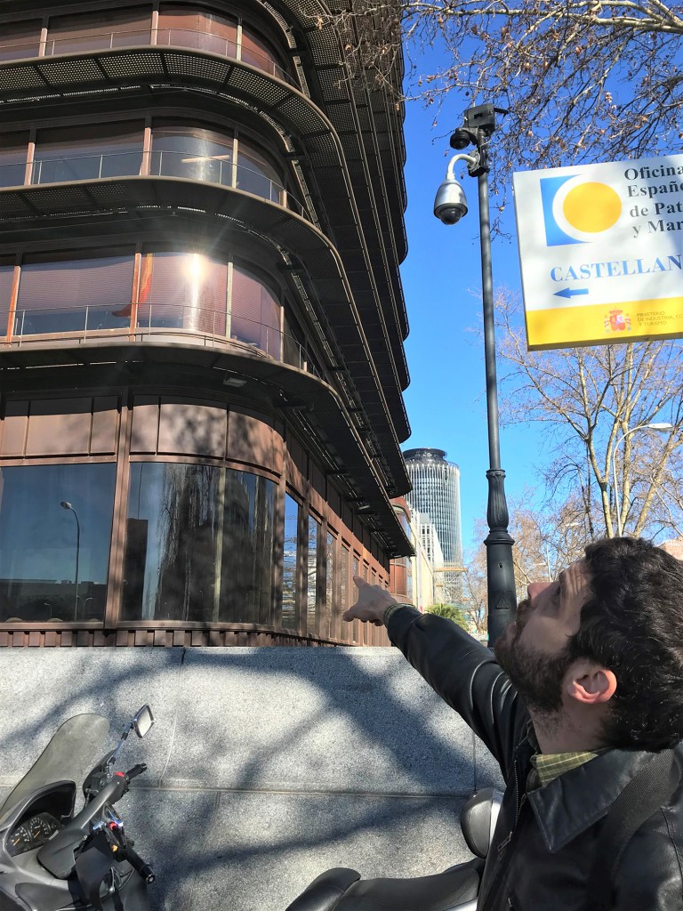
Our guide, Daniel Glattstein Siminovich, explaining ecological techniques utilized by the architects of the BBVA Tower. The striated external walkways around the façade provide shade in the summer – reducing cooling costs and environmental effects. – Rachel Peterson 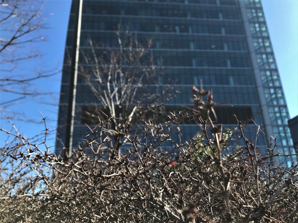
Landscaping at Cuatro Torres controls access points and creates barriers. -Rachel Peterson 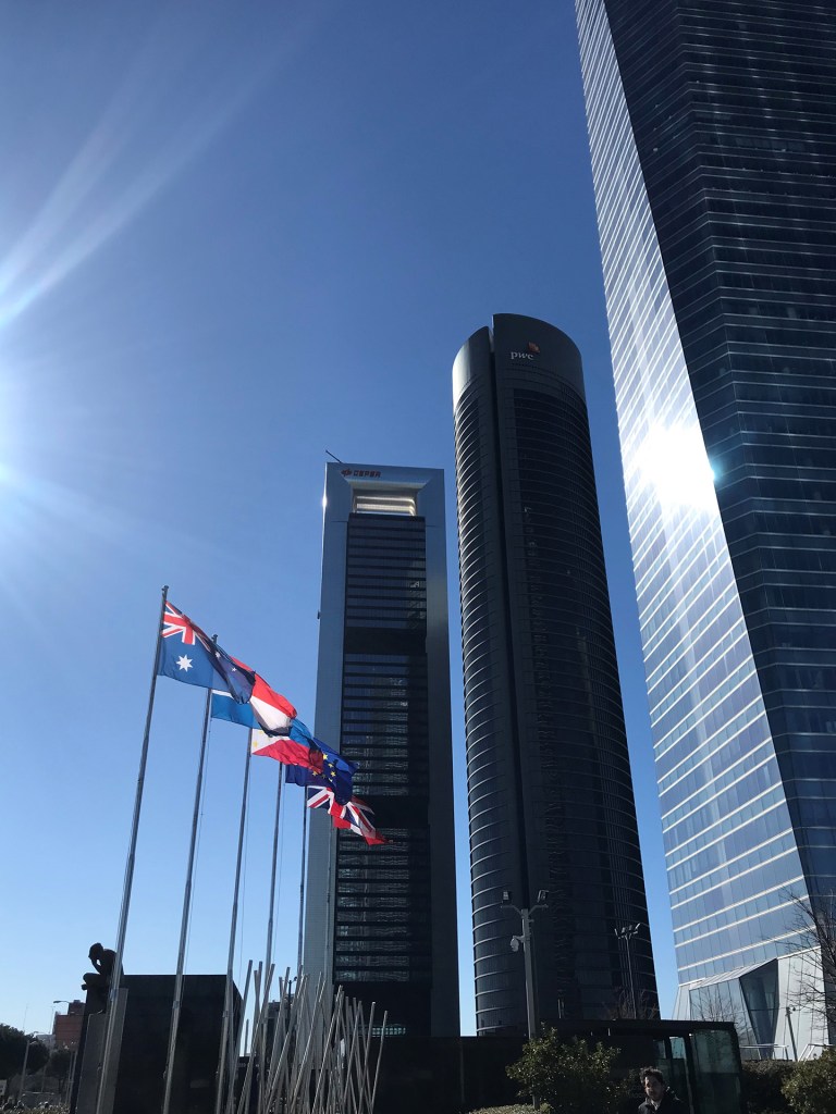
Three of the four towers in Madrid’s developing financial district – Cuatro Torres. – Rachel Peterson 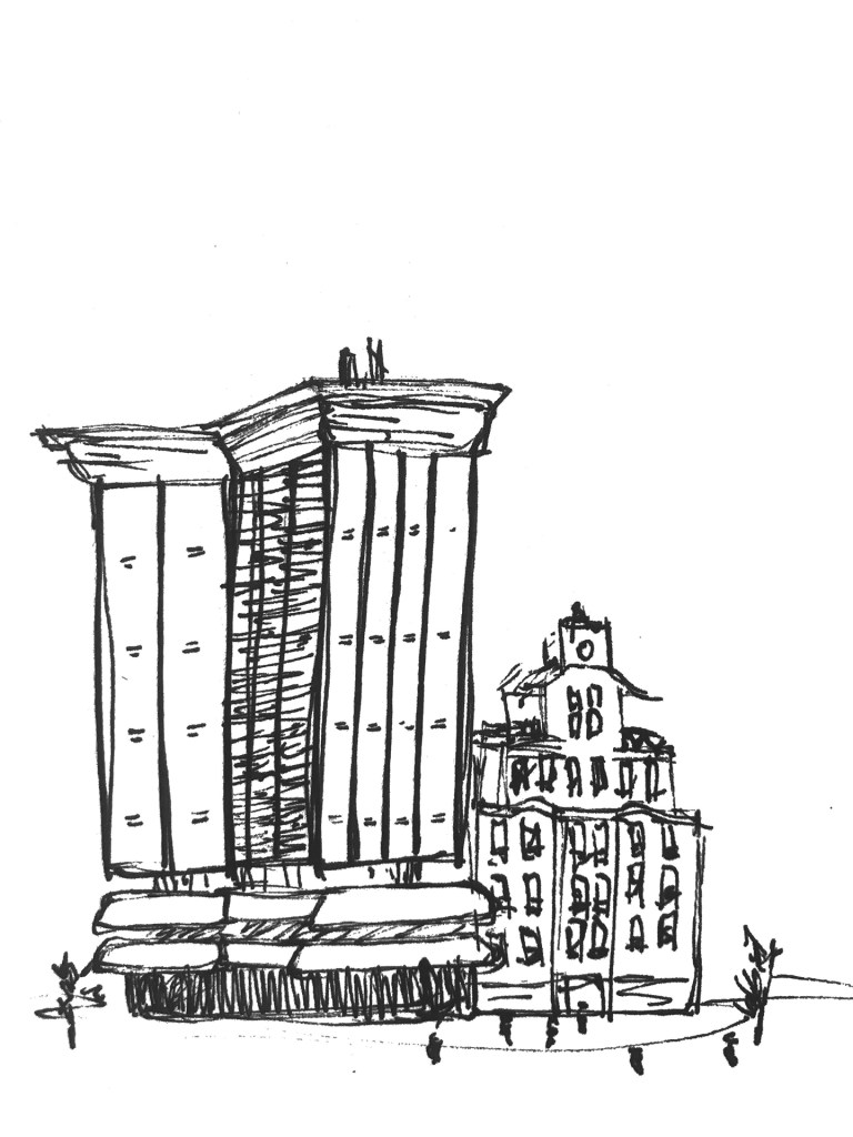
El Torres de Colón adjacent to Crédit Agricole exemplifies the wide range of architecture seen in Madrid. – Rachel Peterson 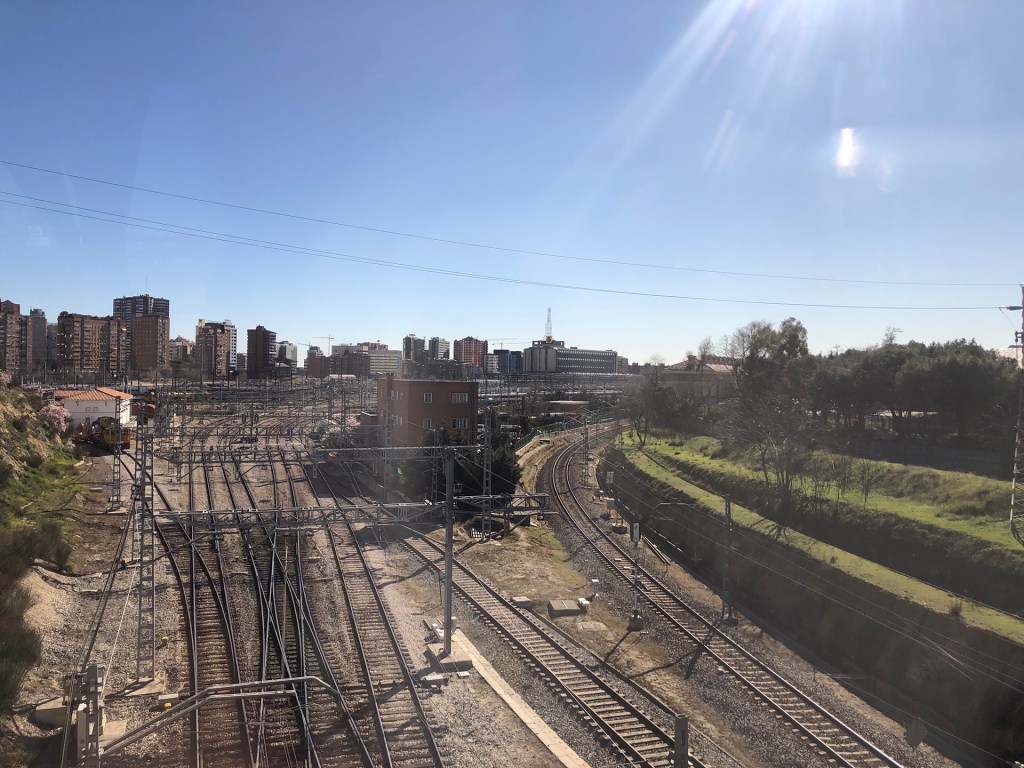
Exposed rail lines near Charmatin Station are proposed to be capped and developed as part of the Nueva Norte project. – Kyle Franta 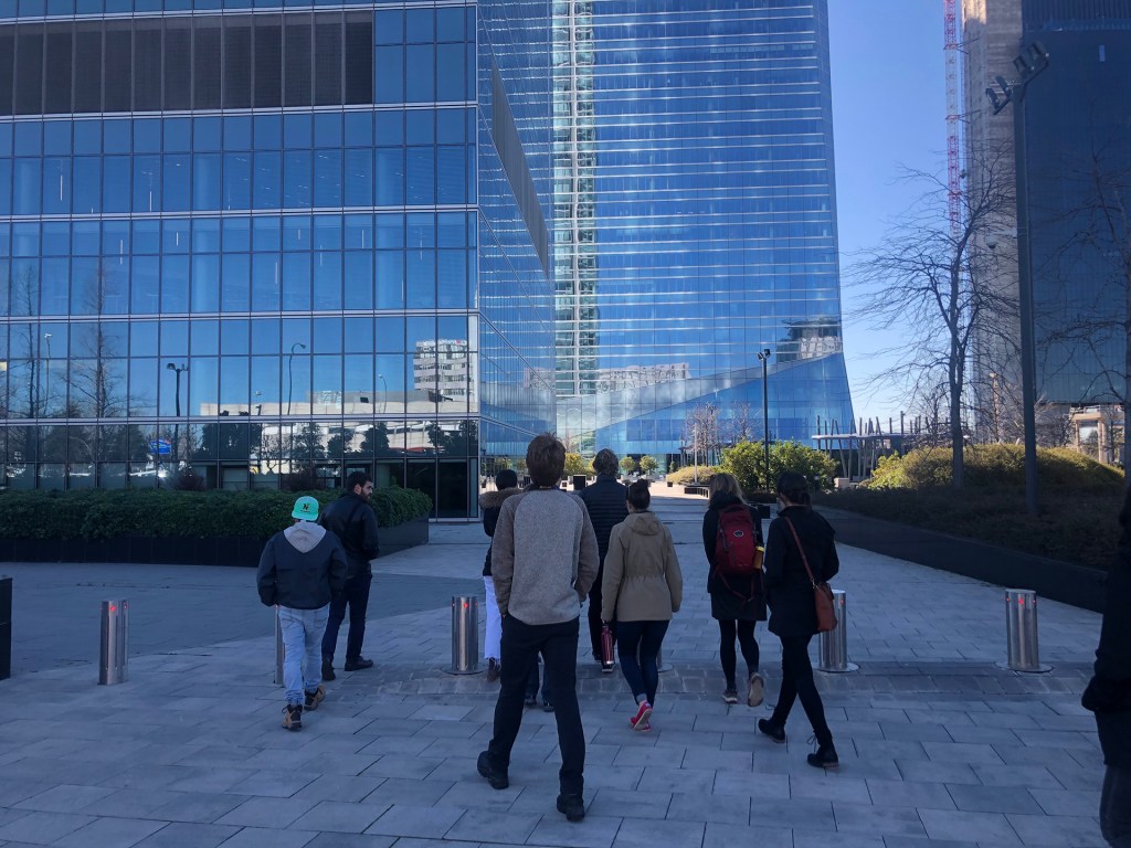
Students touring Cuatro Torres led by Daniel Glattstein Simonovich. -Kyle Franta 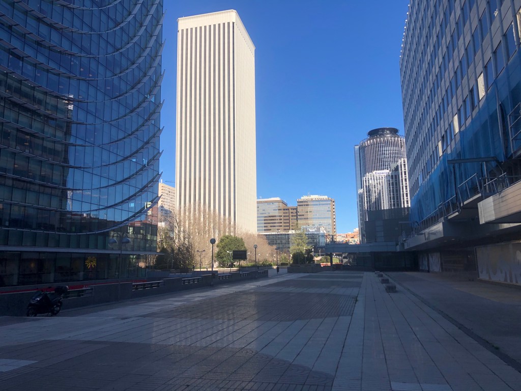
A second story plaza near BBVA created a windy and desolate environment. – Kyle Franta 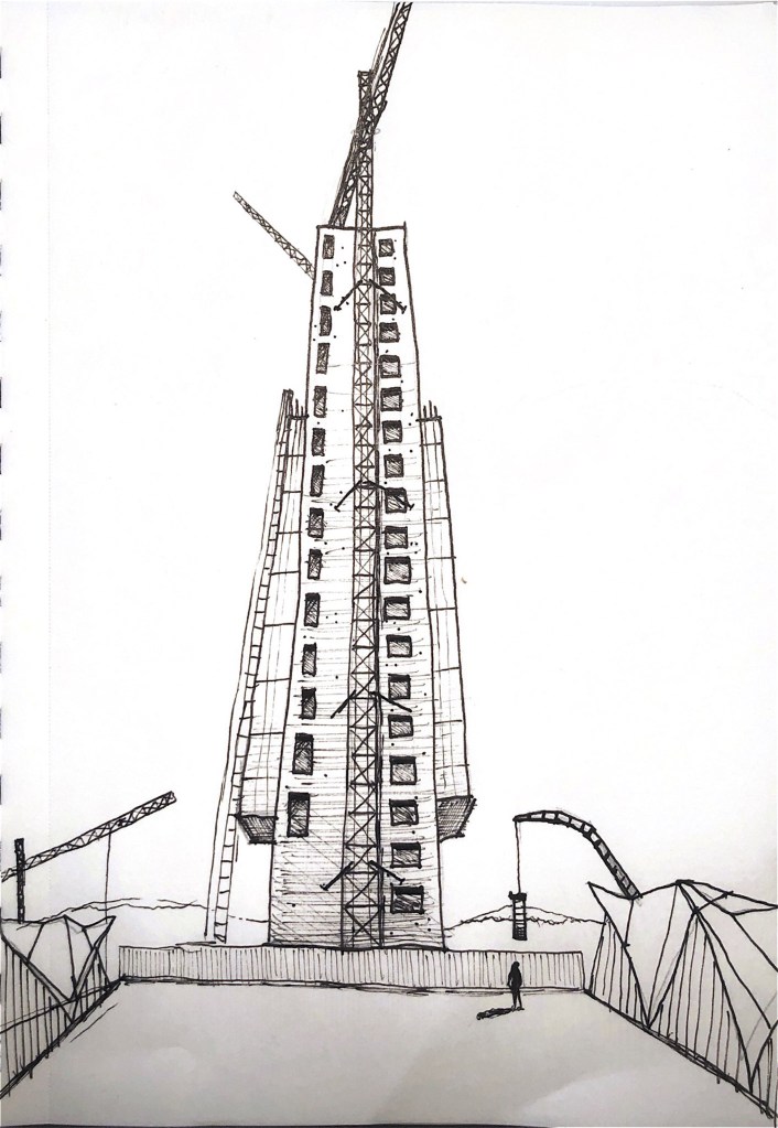
Construction of a new tower at Cuatro Torres. – Kyle Franta
 2020 Cities on Water